Noise Maps
EU Directive 2002/49/EC, transposed into Irish law by the European Communities (Environmental Noise) Regulations 2018 to 2021, calls for the development of strategic noise maps and noise action plans for major roads, railways, airports and agglomerations.
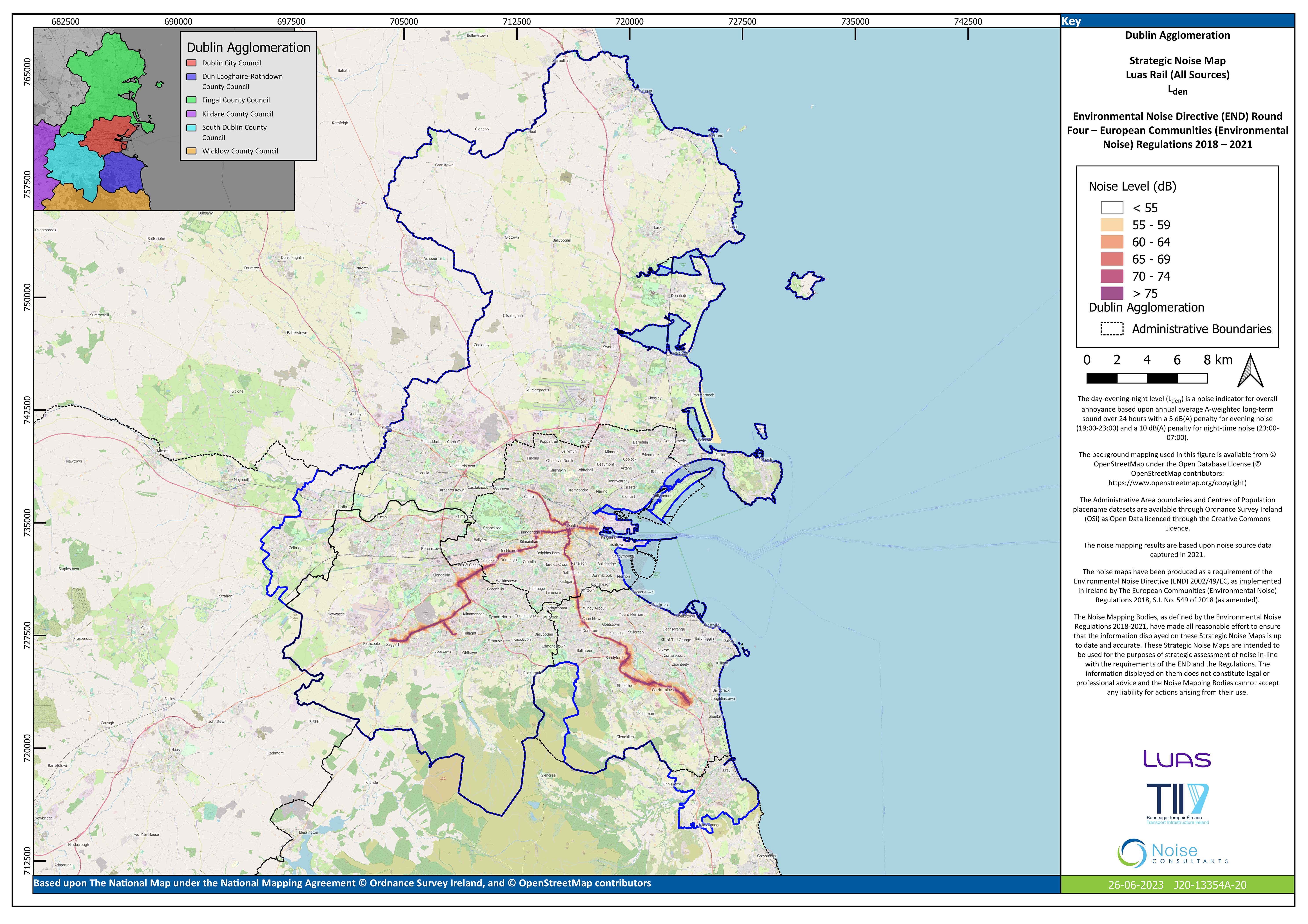
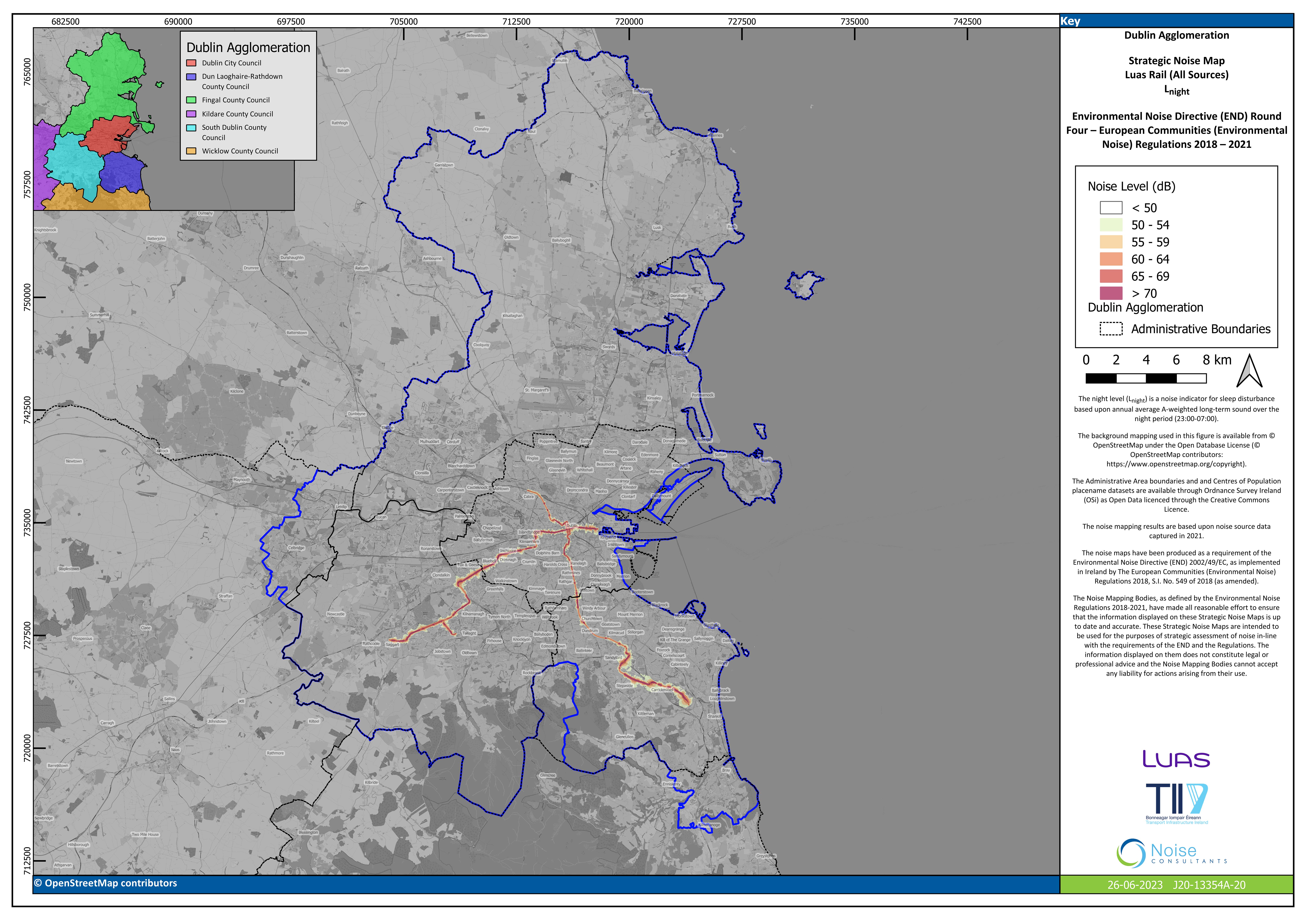
TII is a designated noise mapping body for the development of strategic noise maps for all major national roads carrying in excess of 3 million vehicles a year and for light rail lines.
For the 2022 Phase 4 of noise mapping, strategic noise maps were developed by TII for over 2,100 km of national roads and major non-national roads outside Dublin, Cork and Limerick. Major non-national roads mapped by TII remain under the jurisdiction of the relevant local authority.
The strategic noise maps prepared in 2022/2023 are based on road and light rail traffic movements for Q3 and Q4 2021.
The website displays noise maps for major roads outside the agglomerations of Dublin, Cork and Limerick. The Strategic Noise Maps present noise contours for the following two noise indicators in line with the requirements of the Regulations:
- Lden: Day-evening-night level, with penalties for evening and night noise.
- Lnight: Night level, focusing on sleep disturbance.
Methodology: Noise contours are based on computer modelling using the CNOSSOS-EU methodology, a common noise assessment methodology adopted by the European Commission in line with Article 6.2 of the EC Directive 2002/49/EC and brought into effect through Commission Directive (EU) 2015/996.
Noise Action Plans
Local Authorities are responsible for making and approving noise action plans in their role as designated Action Planning Authorities under the Regulations.