Na Cosantóirí Dearmadta - Dúnáin Inbhear na Sionainne
Le Bryn Coldrick (Archaeological Management Solutions), le rannchur ó Tom Cassidy agus Paul O’Keeffe
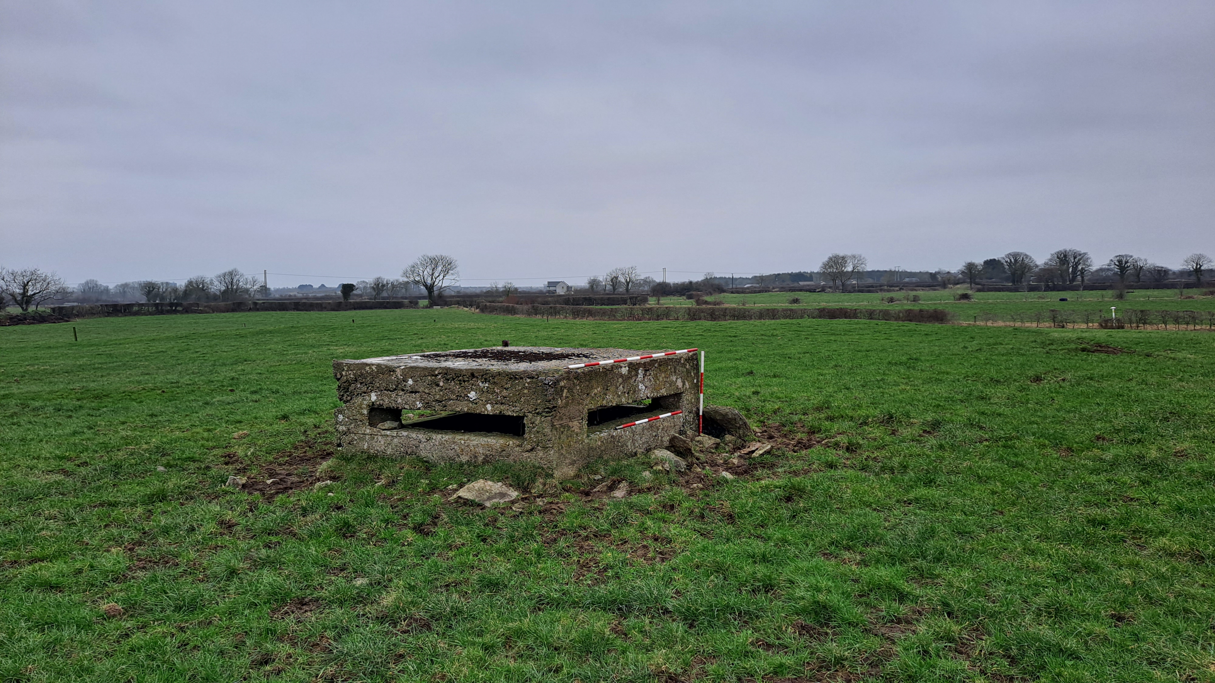
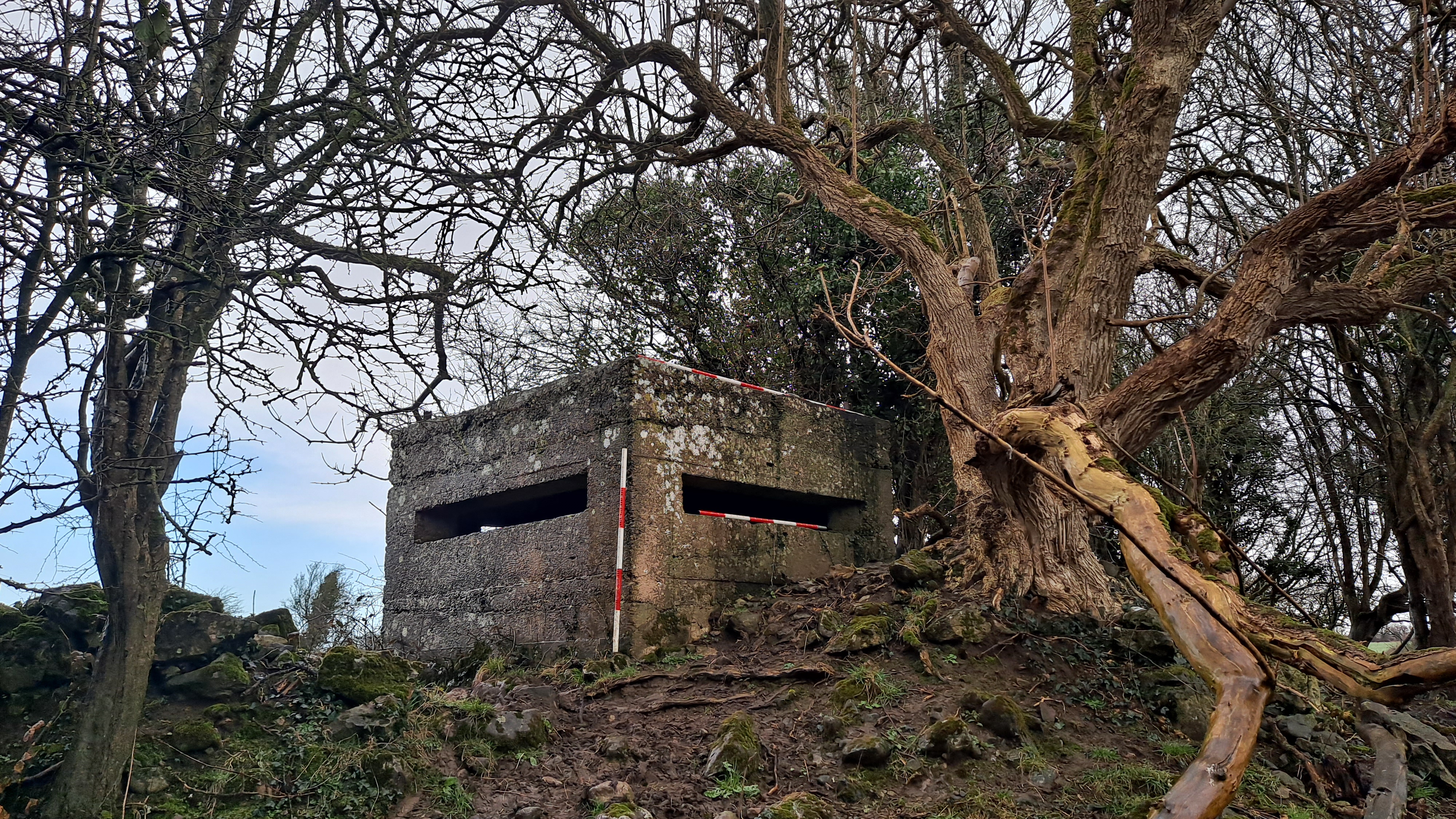
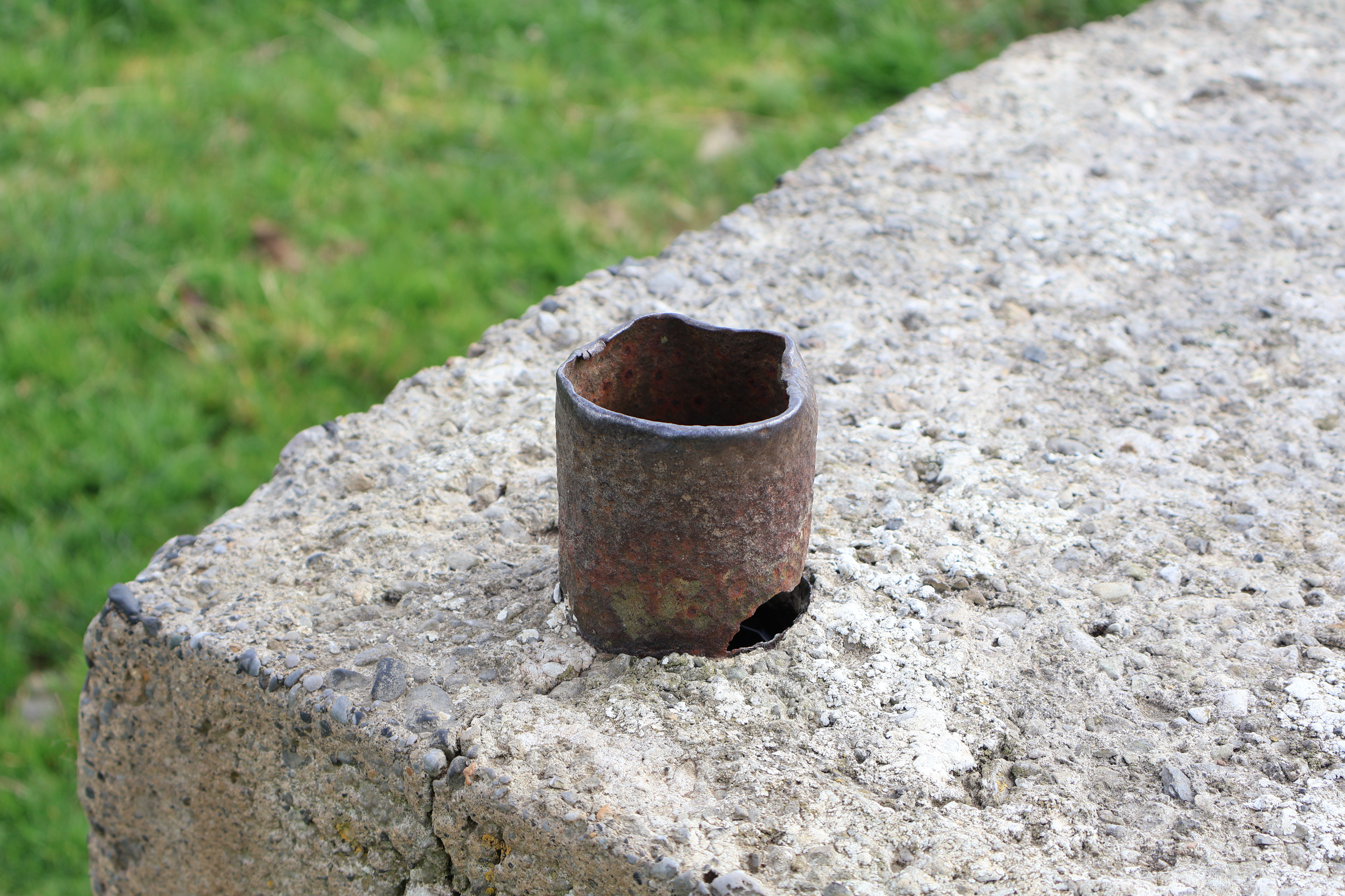
Is déanmhas beag daingean é dúnán atá déanta as coincréit threisithe ina bhfuil oscailtí cúnga (ar a dtugtar go minic feinistrí nó poill lámhaigh) a d’fhéadfaí a úsáid chun raidhfilí nó meaisínghunnaí éadroma a lámhach tríothu agus roinnt cosanta a thabhairt do na saighdiúirí taobh istigh. Feidhmíonn siad cuspóir déach chun faire amach os cionn suíomhanna straitéiseacha amhail bóithre, droichid agus bonneagar tábhachtach eile, agus mar shuíomhanna meaisínghunnaí le moill a chur ar ionsaí ón namhaid agus le cur isteach air. Ba iad na Rúisigh a thóg na chéad dúnáin is luaithe faoi mar is eol dúinn iad le linn a gcogaidh leis an tSeapáin in 1904–05, agus ghlac na Gearmánaigh chucu an cleachtas ar an bhFronta Thiar le linn an Chéad Chogaidh Dhomhanda, agus ghlac na Briotanaigh leis an nós níos moille chun a gcósta a chosaint le linn an dá Chogadh Dhomhanda. Sna luathbhlianta den Dara Cogadh Domhanda, tógadh beagnach 300 dúnán in Éirinn, agus is féidir teacht ar chomhchruinnithe in áiteanna ardluacha straitéisigh, lena n-áirítear an Currach, Gleann na Bóinne agus mórthimpeall ar Inbhear na Sionainne.
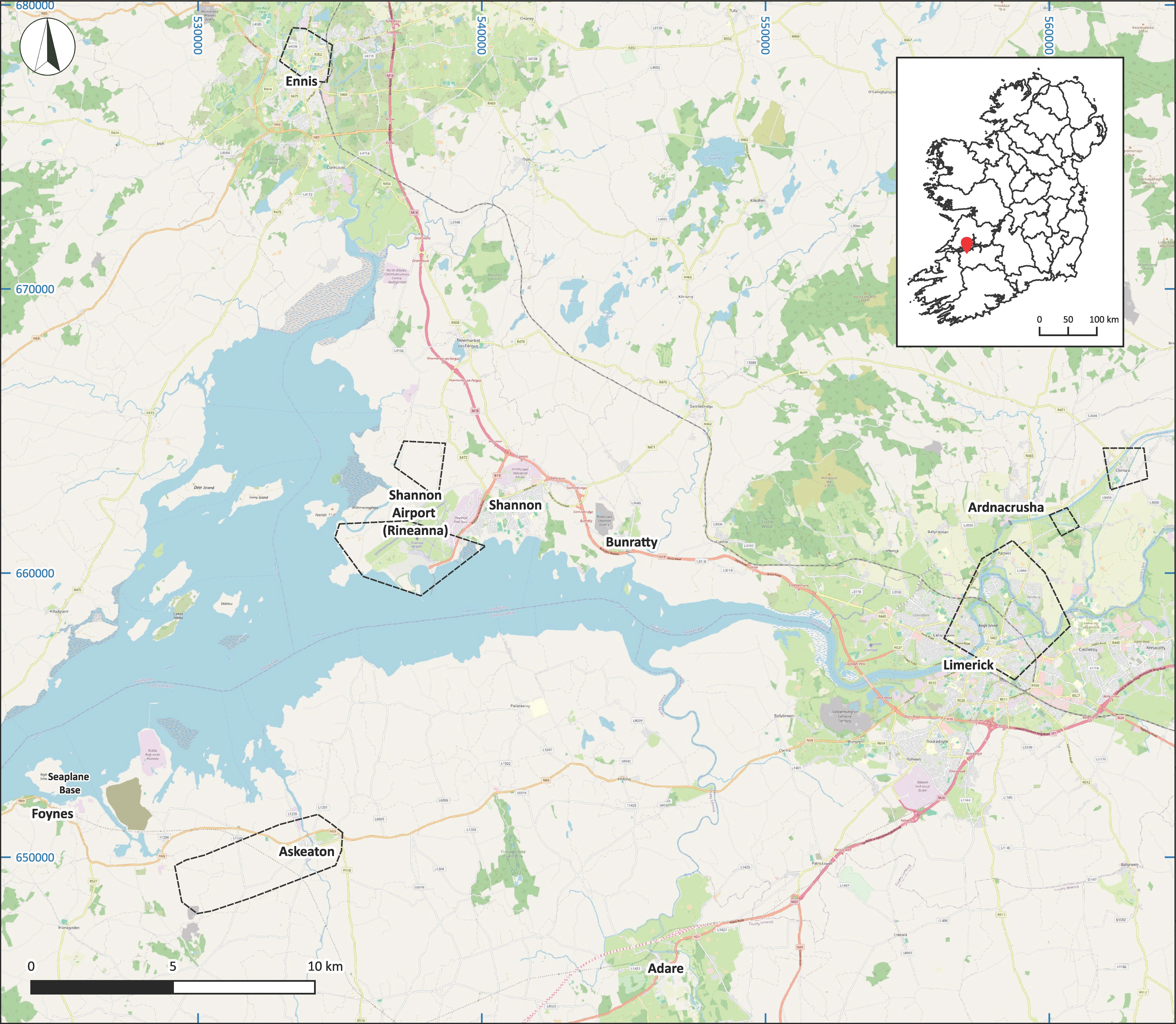
Is é is ábhar ár dtaighde líne dúnán a shíneann siar ó Eas Géitine i gContae Luimnigh, agus go leor acu ag faire thíos ar Inbhear na Sionainne agus Faing ó thuaidh/thiar thuaidh, a bhfuil ‘Braisle Eas Géitine’ tugtha againn orthu. Tá an bhraisle sin mar líne gharbh c. 5.3 km ar fad, ag dul soir ó Pháirc Mholdraig chuig Baile Uí Choilín agus ansin soir ó thuaidh chuig Eas Géitine (Léaráid 7). Bhí naoi gcinn de na dúnáin úd ina láithreáin aitheanta a liostaítear ar Thaifead Chontae Luimnigh ar Dhéanmhais Chosanta (TDC). Taifeadadh ocht ndúnán nach bhfuil liostaithe ar an TDC le linn taighde agus siúlóidí allamuigh a rinne Irish Archaeological Consultancy agus Seandálaí Tionscadail BIÉ le linn na Measúnachta Tionchair Timpeallachta (EIA) don Tionscadal reatha. Sainaithníodh trí cinn de na déanmhais sin sa tuarascáil ina dhiaidh sin ar Mheasúnacht Tionchair Timpeallachta mar ghnéithe suntasacha d’oidhreacht thógtha an cheantair a bheadh thíos le forbairt an bhóthair. Fuarthas sampla eile agus na sceacha á réiteach in ullmhúchán do thógáil an bhóthair nua.
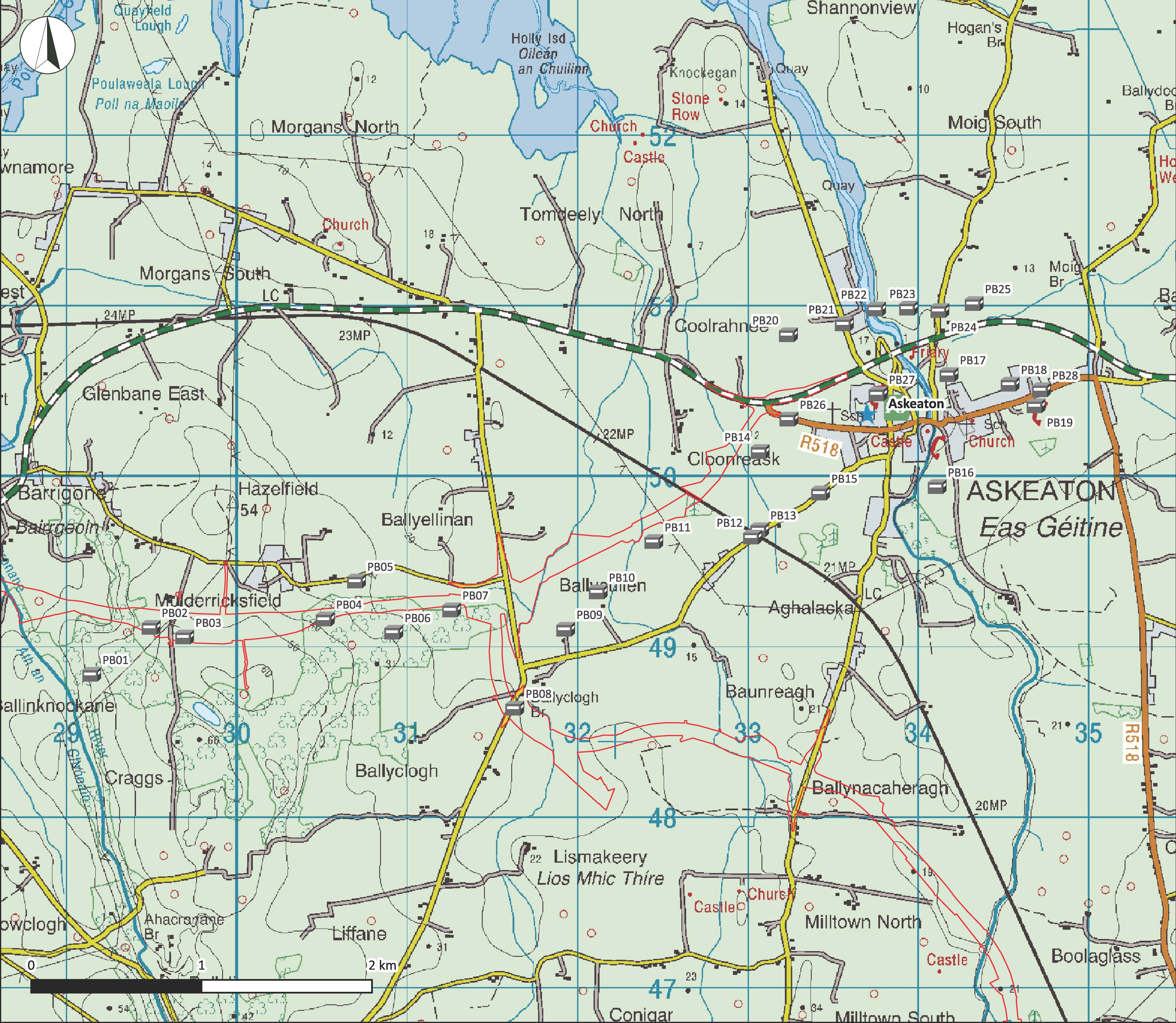
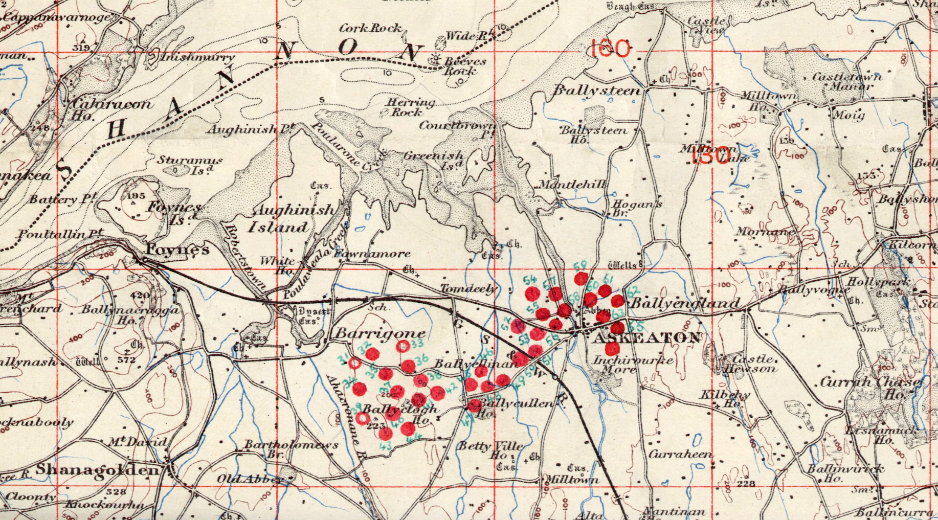
Sa taighde ina dhiaidh sin sa Chartlann Mhíleata i mBaile Átha Cliath fuarthas léarscáil ina léirítear suíomhanna beagnach 70 dúnán timpeall Inbhear na Sionainne, a bhfuarthas a leath (35) díobh timpeall Eas Géitine, cé nárbh ann do roinnt acu a thuilleadh (Léaráidí 8 agus 9).
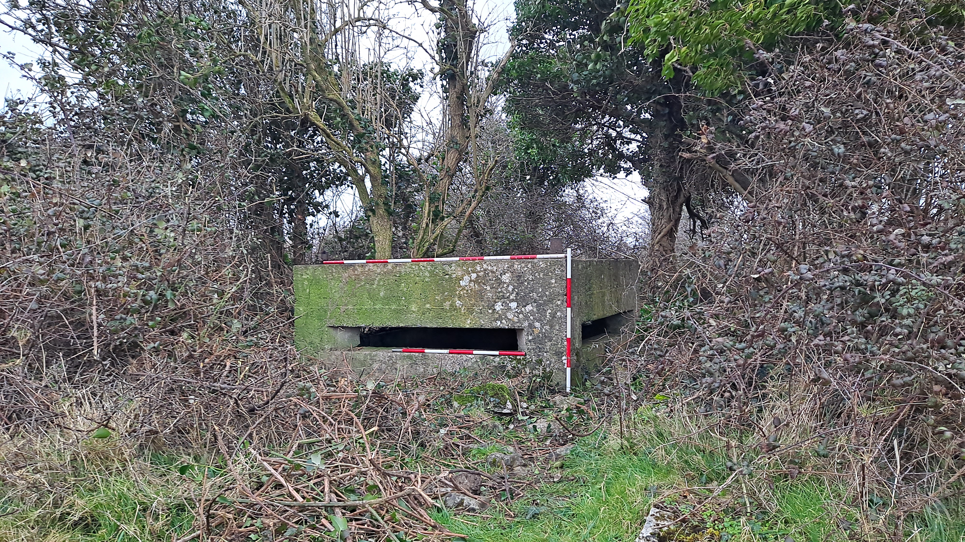
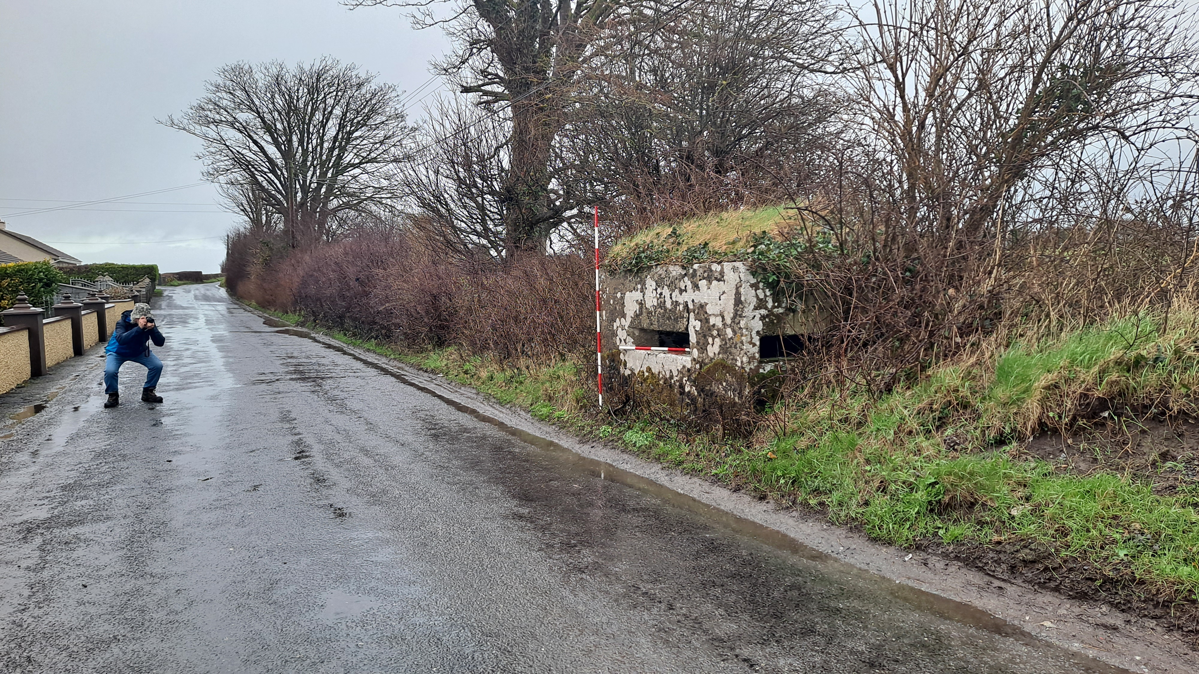
Gné thábhachtach den taighde reatha is ea rannpháirtíocht áitiúil ónar tháinig sainaithint 10 ndúnán a chuaigh gan taifead roimhe, rud a thugann an comhaireamh reatha ar an talamh chuig 28 (24 dúnán atá fós ann agus láithreáin cheithre dhúnán a leagadh). Ba mhinic a thógtaí laistigh de sceacha agus claífoirt iad chun a suíomh a fholú d’aon ghnó. Dá bhrí sin, bíonn mioneolas úinéirí talún agus cónaitheoirí áitiúla ríthábhachtach uaireanta chun teacht ar a suíomhanna.
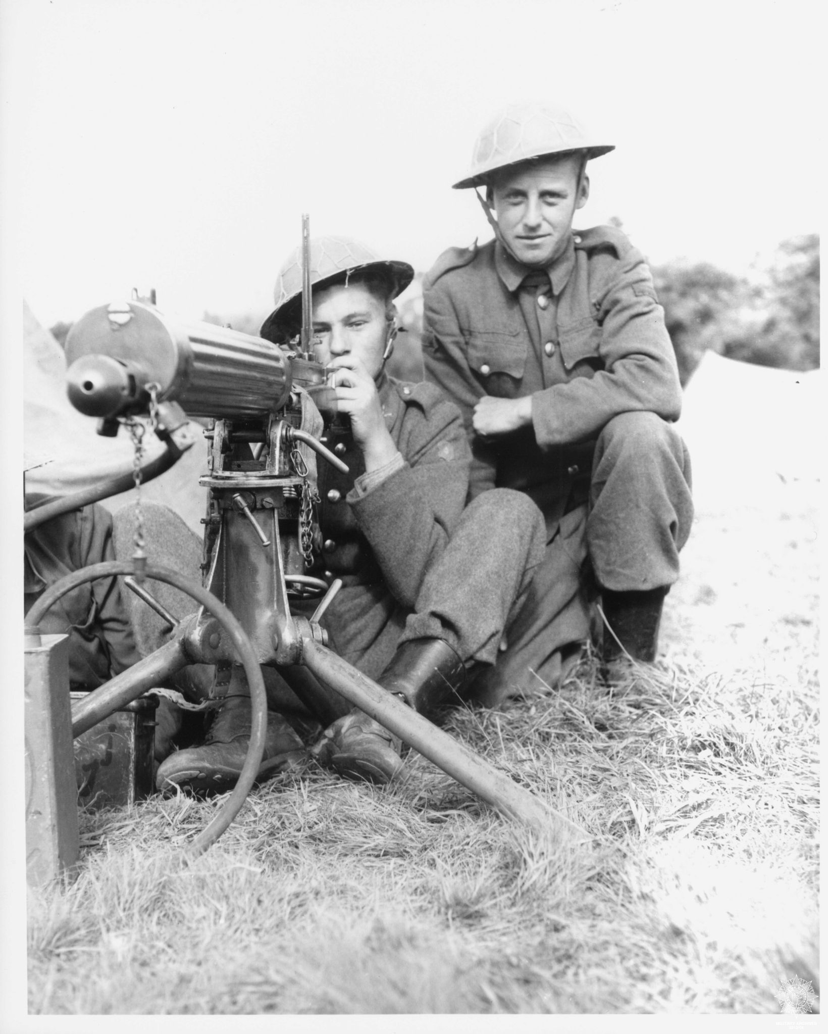
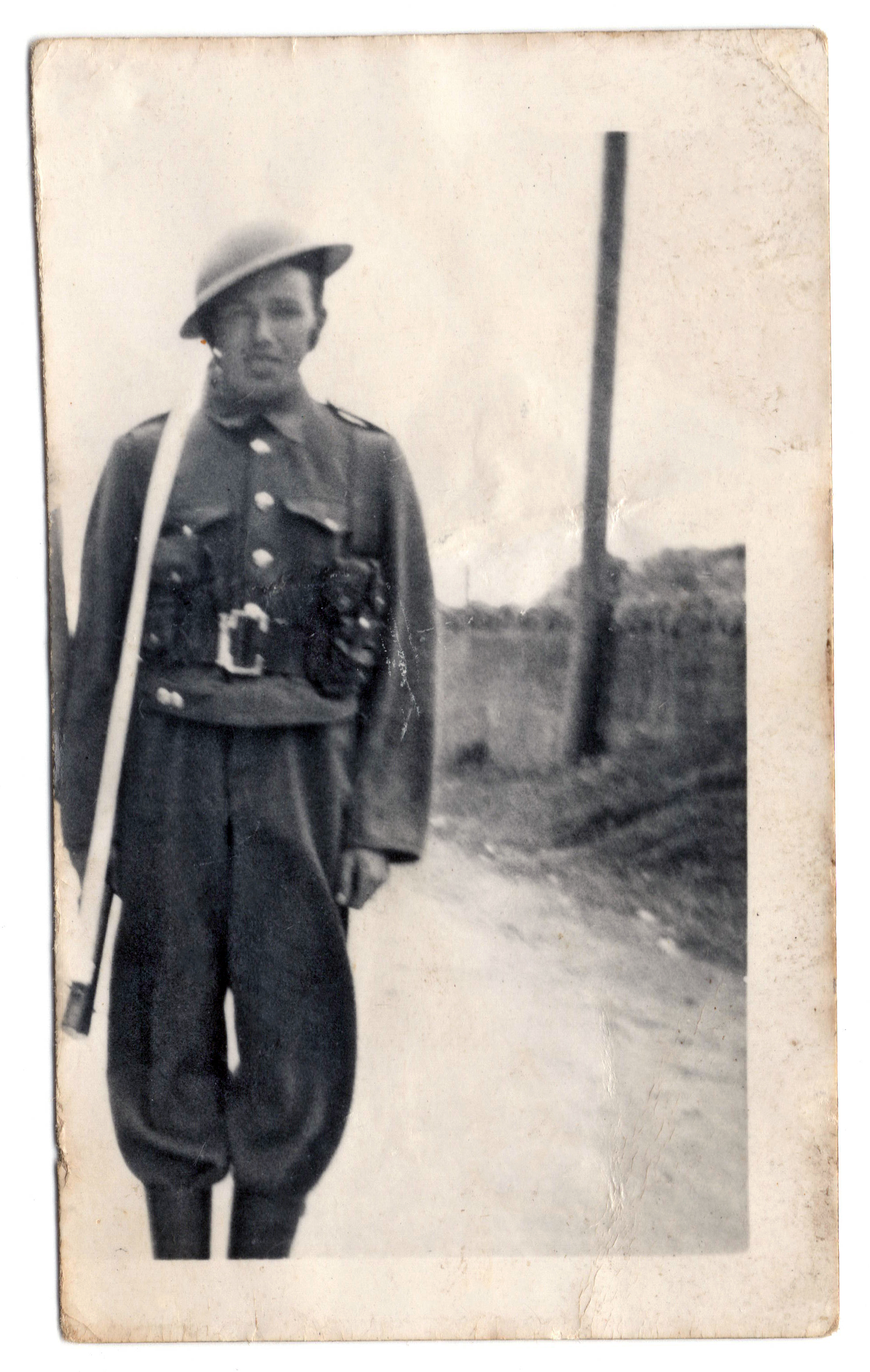
Tá scéalta agus ábhar stairiúil pearsanta á gcomhroinnt freisin ag úinéirí talún agus daoine áitiúla eile linn, lena n-áirítear grianghraif daoine muinteartha a rinne seirbhís san Fhórsa Cosanta Áitiúil (Léaráid 10), agus táimid fós sa tóir ar dhúnáin eile sa cheantar. Trí fheasacht a mhúscailt dá luach stairiúil agus oidhreachta tógtha, d’éirigh linn an pobal áitiúil a shlógadh chun iad a shainaithint, a thuairisciú, agus cuidiú linn iad a thaifeadadh, a bhfuil súil againn go gcinnteofar a gcaomhnú amach anseo leis. Is fíorbheagán dúnán atá taifeadta nó faoi chosaint in Éirinn, rud a fhágann go bhfuil baol ann go gcaillfear iad do na glúnta amach anseo. Léirítear sa saothar seo go gcuireann pobail áitiúla luach iontu mar chuid thábhachtach dár n-oidhreacht thógtha agus mar léiriú inbhraite ar stair an Stáit.
Ceann dár bpríomhchuspóirí taighde is ea iarracht a dhéanamh teacht ar thuiscint faoin gcúis a bhí leis an oiread sin dúnán ón Dara Cogadh Domhanda (ré na hÉigeandála) a bheith le fáil sa cheantar seo. Mar chuid dár dtaighde, chaitheamar súil ar phleananna arna ndréachtú ag Óglaigh na hÉireann thiar in 1940 chun cur i gcoinne ionsaí féideartha ar Éirinn neodrach ón nGearmáin, chomh maith le pleananna ar leithligh cur i gcoinne ionsaí féideartha na gComhghuaillithe a tháinig ón imní go bhféadfadh na Briotanaigh ionradh a dhéanamh ar Éirinn lenár gcalafoirt mhara agus aerpháirceanna a urghabháil agus a úsáid. Bhí Eas Géitine suite ag acomhal idir trí líne chosanta arna sainaithint mar chuid den phleanáil mhíleata sin, agus d’fheidhmeodh an bhraisle thiubh dúnán a tógadh timpeall Eas Géitine in 1940–41 mar ghréasán suíomhanna cosantacha dá dtiocfadh ionradh ón bhfarraige isteach trí Inbhear na Sionainne. Bhí bagairt bhreise d’ionradh ón aer ann a dhíreofaí ar bhunáit na n-eitleán mara ag Faing agus ar an aerpháirc nua ag Rinn Eanaigh (Aerfort na Sionainne anois), chomh maith leis an bhféidearthacht ghinearálta go ndéanfadh paraisiútaithe an namhad ionsaí. Tógadh na dúnáin chun cabhrú leis an mbonneagar ríthábhachtach sin a chosaint chomh maith leis an ngléasra cumhachta hidrileictreach ag Ard na Croise, agus na lárionaid daonra amhail Cathair Luimnigh agus Inis (Léaráid 9). Tá Braisle Eas Géitine suite feadh na líne iarnróid lena nasctar Faing agus Ráth Caola, agus tugann sí cosaint freisin don ghréasáin bóithre áitiúla (Léaráid 8), a d’fhéadfadh an dá cheann acu a bheith ríthábhachtach chun buíonta saighdiúirí agus trealamh an airm rialta a bhogadh go gasta isteach chun saighdiúirí saorálacha an Fhórsa Cosanta Áitiúil a threisiú.
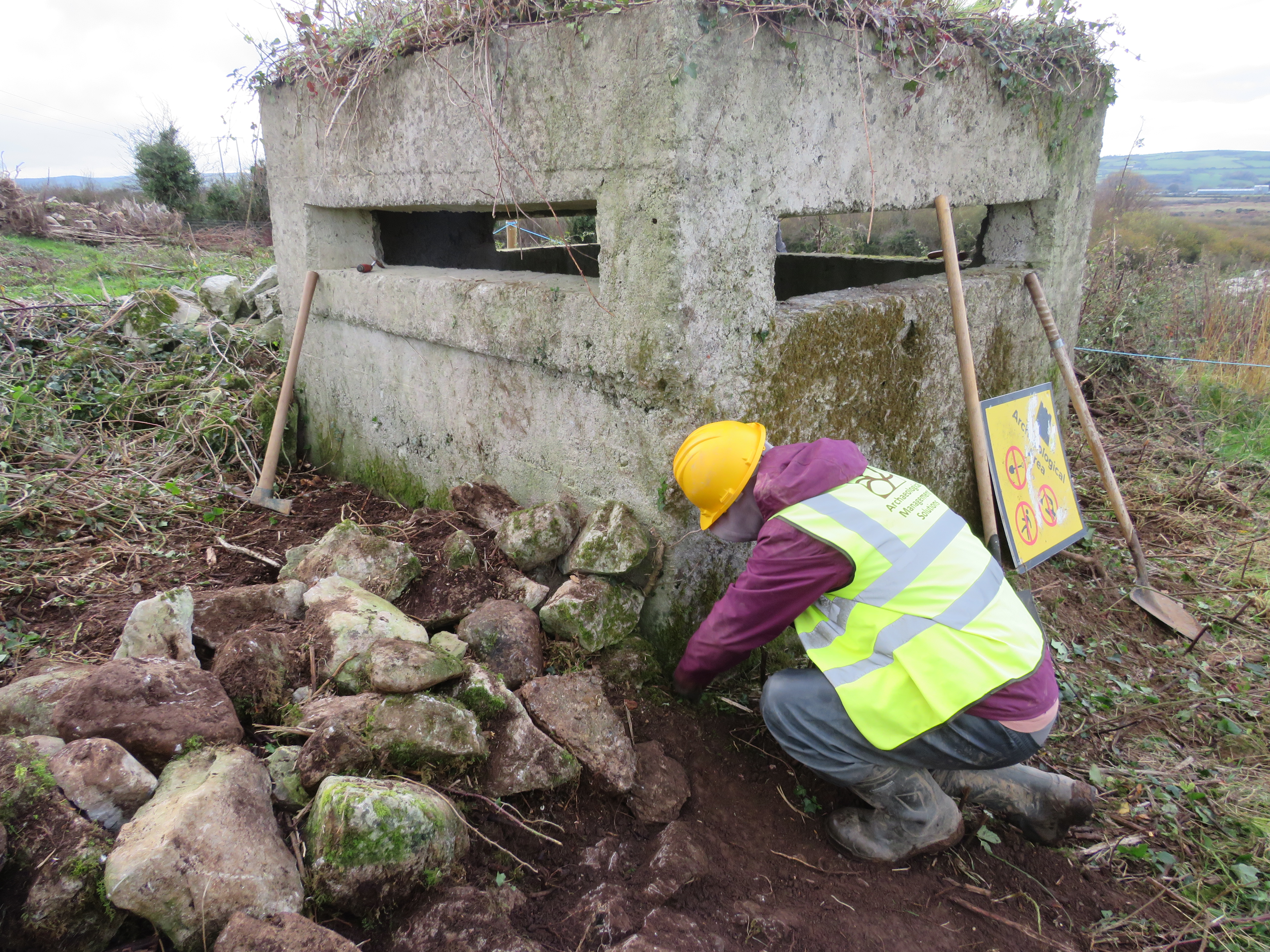
Bíonn suirbhéireacht, doiciméadú agus léarscáiliú ar na dúnáin i gceist leis na suirbhéanna ar an oidhreacht thógtha atá déanta ag AMS mar chuid den tionscadal. Táimid ag déanamh iniúchadh ar na modhanna tógála, lena n-áirítear tochailtí a dhéanamh lena fháil amach a dhoimhne atá siad leabaithe sa talamh agus an cineál bunsraithe ar a bhfuil siad tógtha (Léaráid 11). Táimid ag tabhairt faoi anailís ar limistéar léargais freisin chun an réimse lámhaigh ó fheinistrí (shúile) na ndéanmhas, na limistéir thírdhreacha atá infheicthe ó gach feinistear, agus infheictheacht idir na dúnáin a dhéanamh amach agus a léarscáiliú. Táimid ag tabhairt faoi bhreis taighde stairiúil chun tuiscint níos fearr a fháil ar Bhraisle Eas Géitine agus ar a ról i gcosaint na hÉireann le linn an Dara Cogadh Domhanda. Ar deireadh, tá foireann an tionscadail ag leanúint lenár rannpháirtíocht leis an bpobal áitiúil agus le húinéirí talún chun na déanmhais bheaga shuntasacha sin a thaifeadadh agus a dhoiciméadú, atá ina gcuid ríthábhachtach d’oidhreacht chosanta d’Éirinn neamhspleách.
Táimid ag tabhairt torthaí ár dtaighde ar ais go dtí an pobal áitiúil trí mheán cainteanna agus foilseachán (ar líne agus i gcló), agus cuirfear ár dtuarascálacha teicniúla agus aschuir eile ar fáil faoi dheireadh trí Bhailiúcháin Oidhreachta Digití BIÉ tráth chríochnú an tionscadail. Idir an dá linn, tá úsáid bainte as fótagraiméadracht ag an seandálaí AMS John Channing chun samhlacha digiteacha 3T a tháirgeadh de roinnt de na dúnáin in Eas Géitine is féidir a fheiceáil ar Sketchfab, agus is féidir físeán a fheiceáil darb ainm The Forgotten Defenders: Pillboxes of the Shannon Estuary ar chainéal Youtube AMS.
Léitheoireacht Bhreise
Barry, M B & O’Byrne, J 2024 The Emergency in Colour: Ireland in Wartime. Gill Books, Dublin. French, N n.d. ‘World War II’. Meath History Hub (https://meathhistoryhub.ie/world-war-ii/).
Gray, T 1997 The Lost Years: The Emergency in Ireland 1939–45. Little, Brown & Co., London.
Kennedy, M 2008 Guarding Neutral Ireland: The Coast Watching Service and Military Intelligence, 1939–1945. Four Courts Press, Dublin.
Kerrigan, P M 1995 Castles and Fortifications in Ireland 1485–1945. The Collins Press, Cork.
Historic England 2023 ‘A Brief Introduction to Military Pillboxes’ (https://heritagecalling.com/2023/10/19/a-brief-introduction-to-military-pillboxes).
MacCarron, D 1999 Step Together! Ireland’s Emergency Army 1939–46 as told by its Veterans. Irish Academic Press, Dublin.
McEnery, J H 2006 Fortress Ireland: The Story of the Irish Coastal Forts and the River Shannon Defence Line. Wordwell, Bray.
Litton, H 2001 The World War II Years: The Irish Emergency an Illustrated History. Wolfhound Press, Dublin.
O’Halpin, E 1999 Defending Ireland: The Irish State and its Enemies Since 1922. Oxford University Press, Oxford.
Osborne, M 2008 Pillboxes of Britain and Ireland. The History Press, Stroud.
Pillbox Study Group (PSG) 2025 ‘Committed to the Study and Preservation of 20th Century United Kingdom and International Pillboxes and Anti-Invasion Defences’ (http://www.pillbox-study-group.org.uk).
Stout, G & O’Reilly, M 2000 ‘Pillboxes on the Boyne (1939–45)’, in Journal of the Old Drogheda Society, No. 12.
Stout, G 2002 Newgrange and the Bend of the Boyne. Cork University Press, Cork.