Traces of Iron Age metalworking - evidence from the N73 Road Scheme, Co. Cork
by Graham Hull of TVAS (Ireland) Ltd
The route of the N73 winds its way across the fertile lands of north County Cork, linking the historic towns of Mallow and Mitchelstown. Archaeological investigations in advance of realignment works on various parts of the N73, undertaken over several phases between 2012 and 2020, led to the discovery of nine previously unrecorded archaeological sites (Illus. 1). These excavations yielded tantalising snapshots into the lives of people who lived in this part of north Cork since early prehistoric times. Four of the sites contained evidence of life in the Iron Age (800 BC to AD 400). The Iron Age in Ireland has been poorly understood for many years; however, recent research and large-scale excavations (Becker et al. 2017) have increased our understanding of life during this period, including developments in metalworking technologies.
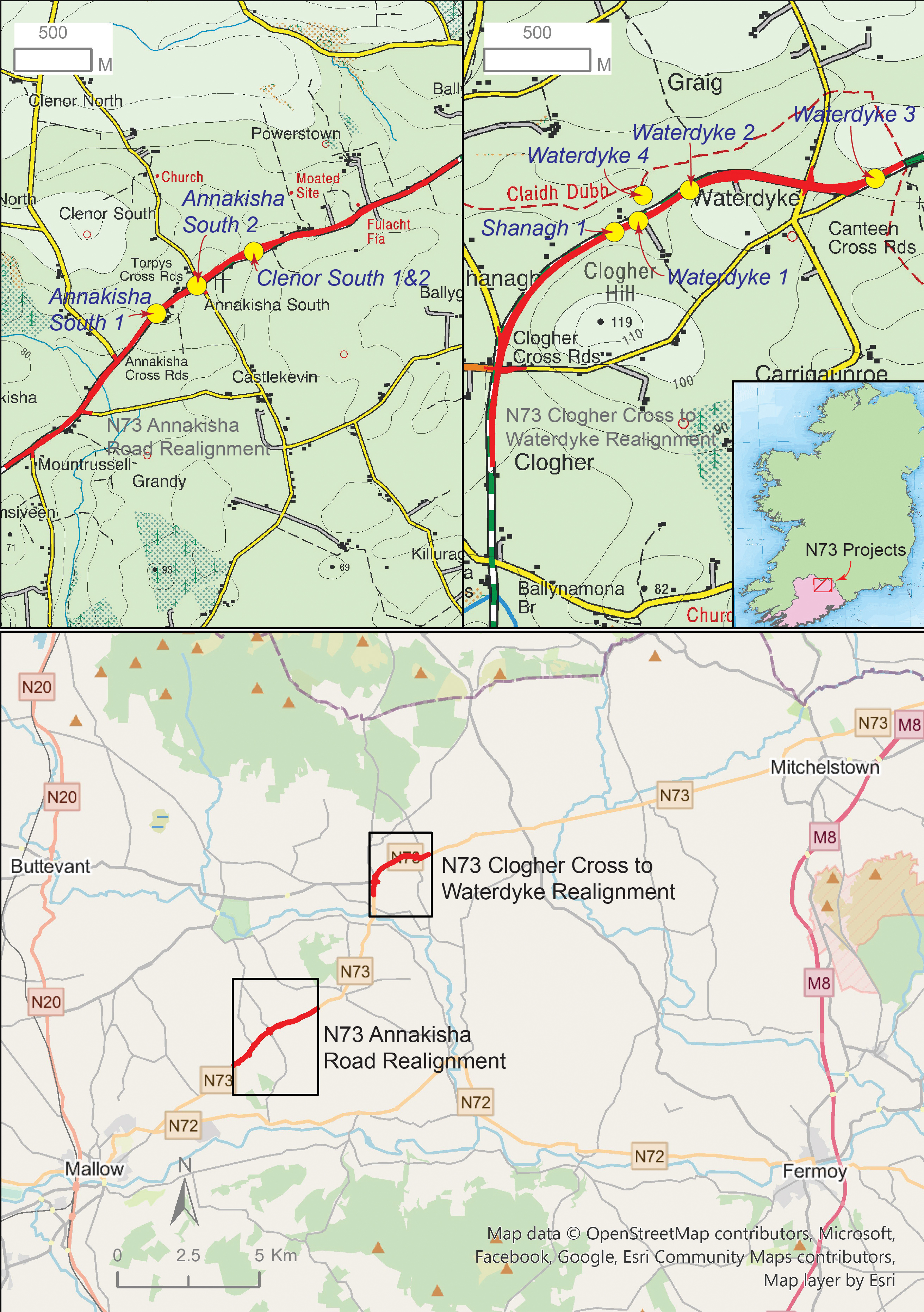
Non-ferrous metalworking at Annakisha South 1
Annakisha South 1 (excavation licence no. 19E0713) was excavated under the direction of Graham Hull in 2019, some 6 km north-east of Mallow town. Though a small site, containing just a few pits, it produced an artefact that reveals fascinating insights into Iron Age craft production.
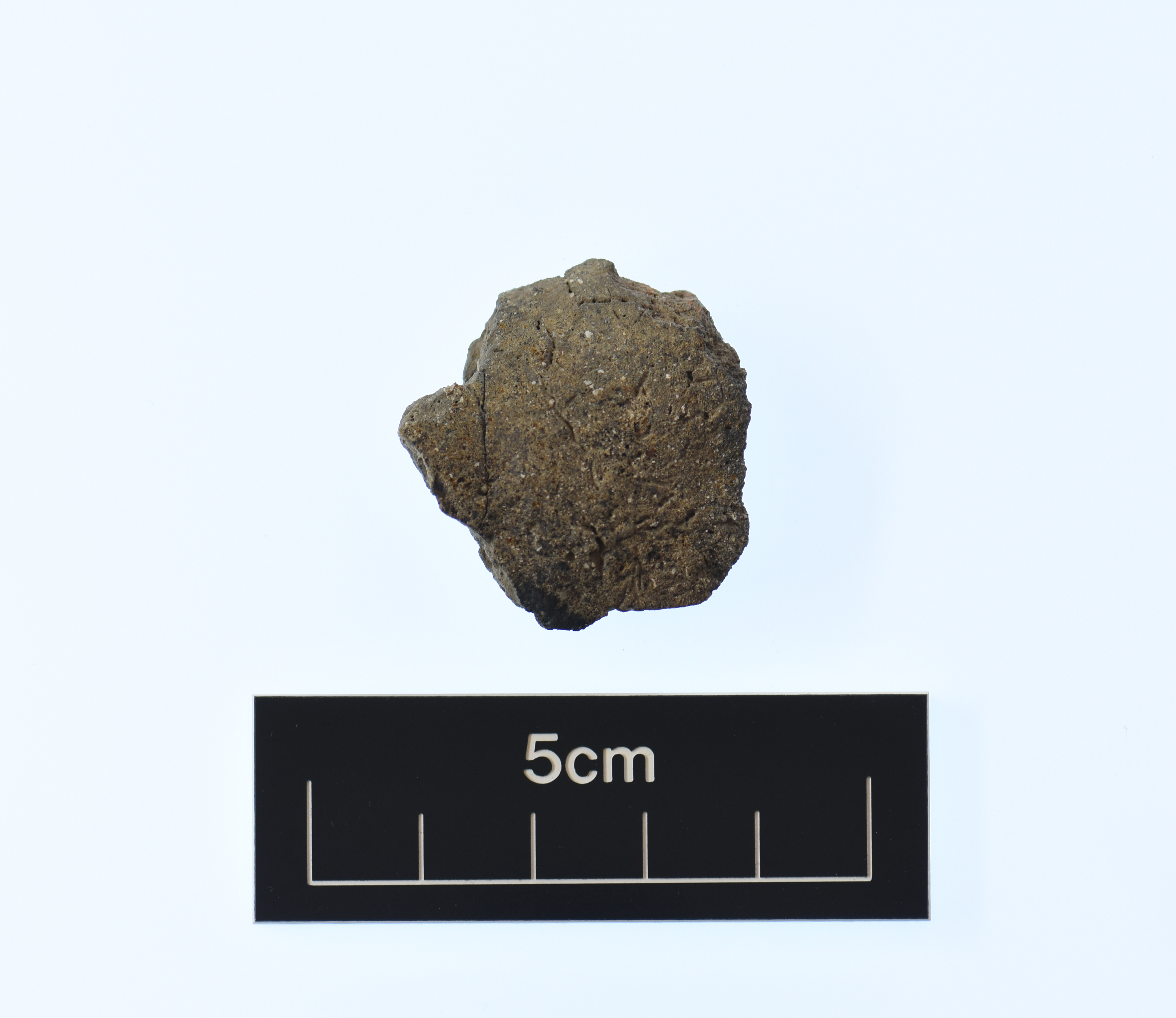
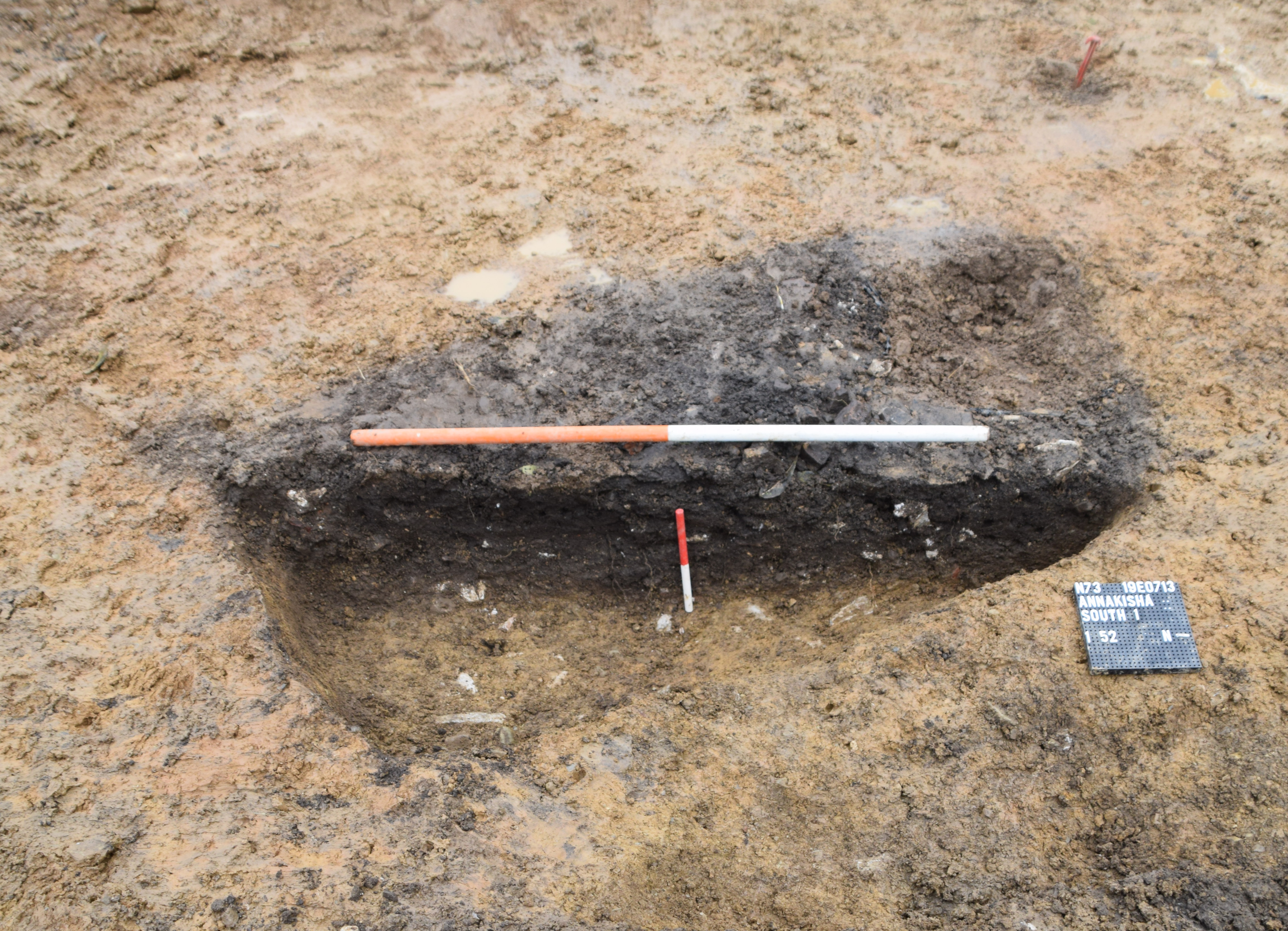
A fragment of a ceramic crucible (artefact no. 19E0713:52:1; Illus. 2) was found in the upper fill of one of the excavated pits. This sub-rectangular pit (Illus. 3) was filled with charcoal-rich soil that contained—alongside the crucible fragment—an assemblage of bone from cattle and pig, evidence of food consumption, presumably from a nearby settlement. Charcoal from the pit was from ash, oak, alder, hazel, willow, holly, elm, birch and pomaceous woods, showing the diversity of woodland that surrounded Annakisha at the time.
A radiocarbon determination on a large mammal bone (probably cattle) found in the pit returned a date of 168 BC–AD 18, dating the pit and its contents to the mid to late Iron Age.
The crucible
Despite its small size, the crucible fragment revealed a great deal about its use. Detailed scientific analysis by Dr Brendan O’Neill (UCD) was particularly informative.
The sherd itself is mid grey brown in colour, measures 2.90 cm by 2.50 cm, and is 1.00 cm thick (Illus. 4). The diagnostic evidence available from examining the sherd points towards it belonging to a shallow triangular or globular type of crucible common across Britain and Ireland at the time.
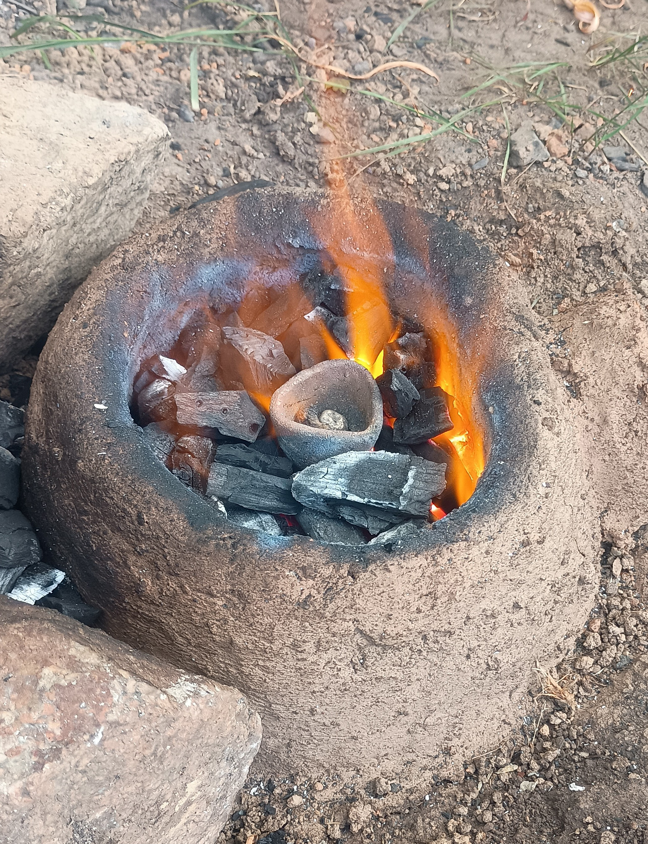
The exterior surface of the sherd is hard and in a relatively good condition. Unfortunately, the interior surface is heavily abraded and more friable. The exterior of the sherd has been vitrified (glazed) and lightly vesiculated (bubbled) because of the heating processes. It appears that this crucible was heated externally rather than internally (both methods are known from the archaeological record), and from below the vessel (Illus. 5). Levels of vitrification are a direct result of contact with heat: the higher the temperature, the greater the likelihood and extent of vitrification.
A pillbox is a small, sturdy structure made from reinforced concrete with narrow openings (often referred to as embrasures or gun loops) that could be used to fire rifles or light machineguns through while giving some protection to soldiers inside. They served a dual purpose of watching over strategic positions such as roads, bridges and other important infrastructure, and as fixed machinegun positions to delay and disrupt an enemy attack. The earliest pillboxes as we know them were built by the Russians during their war with Japan in 1904–05, then by Germans on the Western Front during World War I, and the idea was later taken up by the British to protect their coastline during both World Wars. In the early years of World War II, almost 300 pillboxes were built in Ireland, and concentrations can be found in places of high strategic value, including the Curragh, the Boyne Valley and around the Shannon Estuary.
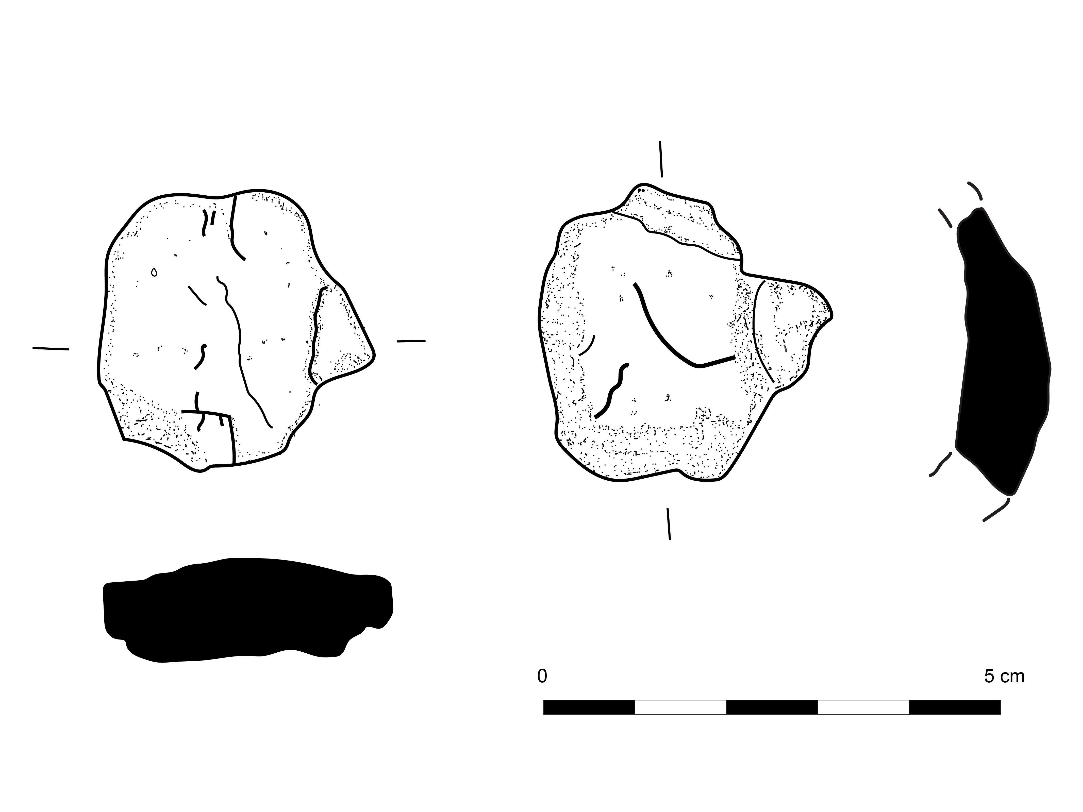
The profile of the fragment indicates a tapering or globular vessel with a slightly inverted rim, and it is noticeable that at the upper part of the sherd the vessel wall becomes much thinner. The crucible may have originally possessed a lid; however, due to the small size of the fragment, it is impossible to discern if it was manufactured with a spout. The vessel was made from clay with a distinct fabric, containing both quartz and organic temper. Consistent with the radiocarbon date from the pit, the vessel is of a type known to have been used during the Iron Age.
The results of elemental analysis—examining chemical residues absorbed into the fabric of the crucible—show that, at the very least, this vessel was used to melt an alloy of copper and silver. The crucible may also have been used to melt tin, though it is very likely this was on a separate occasion to the creation of the copper/silver alloy.
Iron Age crucibles are rarely found on archaeological sites, and this small fragment is a significant addition to our understanding of later prehistoric crucible-making and non-ferrous metallurgy.
Although just one metalworking object was found on the site at Annakisha South 1, the crucible represents one of the many stages in the complex process of the manufacture of metal artefacts. Prior to the use of the crucible the ore would have been mined and the metal extracted and purified. Once the metals had been melted together in the crucible, the liquid alloy would have been poured into a clay or stone mould to form some of the finer metalwork pieces known from Iron Age Ireland.
Iron working at Clenor South 2
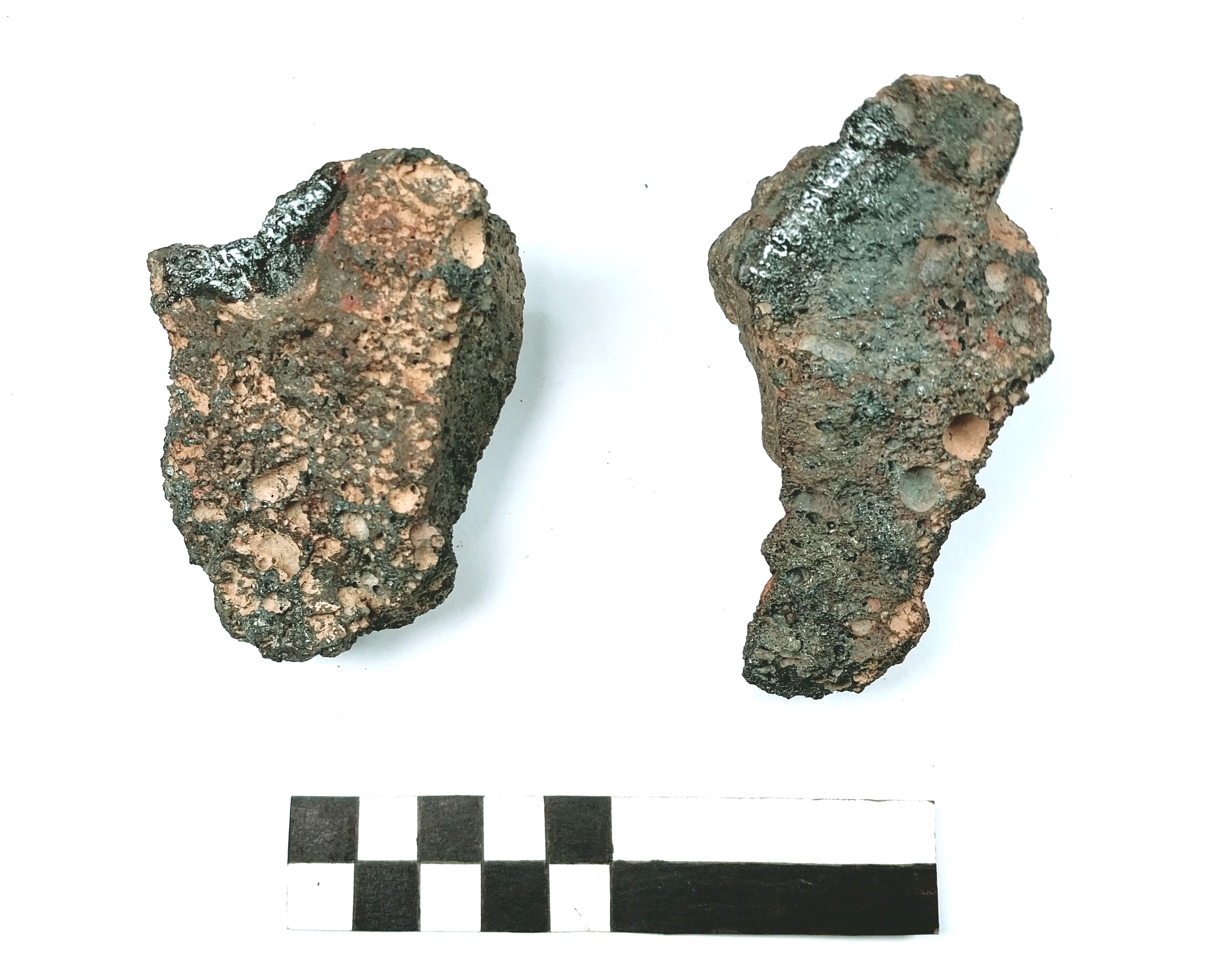
At around the same time as the crucible was being used to alloy copper and silver at Annakisha South 1, a different type of metalworking was taking place approximately 620 m to the north-east, as seen at the excavated site of Clenor South 2 (19E0715). Although the Iron Age is, as the name suggests, the period where iron was introduced to Ireland, evidence for prehistoric blacksmithing is rare. At Clenor South, two hearths with charcoal-rich fills and evidence of in situ burning were radiocarbon dated to 196 BC–AD 3 (charred barley grain) and 174 BC–AD 7 (hazel charcoal). Fragments of a smithing hearth cake (waste from ironworking) were found in one of the hearths (Illus. 6). Together these features suggest iron was being worked into objects such as tools or weapons during this period.
Charcoal production at the end of the Iron Age at Waterdyke 2 and 3
Two other sites excavated on the N73 in 2012, on the Clogher Cross to Waterdyke scheme, produced evidence of Iron Age activity, albeit some centuries later in date. The sites of Waterdyke 2 (12E0083) and Waterdyke 3 (12E0084), excavated by Edel Ruttle 7.5 km north-east of Clenor South 2, both yielded evidence of the production of charcoal at the end of the Iron Age or the start of the early medieval period. At Waterdyke 2, a charcoal-production pit was radiocarbon dated to AD 266–535 (oak charcoal), whilst at nearby Waterdyke 3, two further charcoal-production pits were dated to AD 342–538 (oak charcoal) and AD 425–579 (oak charcoal).
To make charcoal, wood (usually oak) is allowed to smoulder in an environment where oxygen is controlled so that the wood carbonises rather than burning up completely. At Waterdyke, this took place in shallow pits that would probably have been covered with turves to control the burning process. These distinctive pits, where the underlying ground surface is heavily oxidised, are often found on archaeological excavations and were in use from the Iron Age through to the medieval period and beyond. Charcoal was an essential fuel for iron manufacture and, although iron-working sites are less commonly found, the discovery of charcoal-production features suggests that ironworking was commonplace throughout Ireland during the Iron Age.
Iron Age activity is also represented in the locality by the 22.5 km long linear earthwork An Claidh Dubh (Sites and Monument Record no. CO018-001----). This impressive earthwork implies a heightened level of societal stress at the time it was created; this being a regional scale monument built, apparently, for defence.
Taken together, the evidence from these four sites during investigations carried out in advance of two nearby N73 road realignment schemes reveal metalworking of iron, tin, copper and silver, casting more light (pun intended) on the lives of the people who dwelt in the landscape of north County Cork in the Iron Age.
Several articles from the scheme have been published (see Further Reading below).
Further reading
Becker, K, Armit, I & Swindles, G T 2017 ‘New Perspectives on the Irish iron Age: the impact of NRA development on our understanding of later prehistory’, in M Stanley, R Swan & A O’Sullivan (eds), Stories of Ireland’s Past: knowledge gained from NRA roads archaeology, 85–100. TII Heritage 5. Transport Infrastructure Ireland, Dublin.
Hull, G 2020 ‘Continuity of place: initial results of archaeological investigation in advance of the N73 Annakisha Realignment Scheme’, Mallow Field Club Journal, Vol. 38, 127–40.
Hull, G & Ruttle, E 2024 ‘From first farmers to roadside forge: archaeological discoveries from two N73 road re-alignment schemes, in north County Cork’, Journal of the Cork Archaeological and Historical Society, Vol. 129, 31–73.
Maguire, R, Taylor, K & Maguire, J 2023 ‘Forging rural heritage: observations from recent archaeological excavations at Clenor South and Annakisha South, County Cork, Ireland’, Cheiron: The International Journal of Equine and Equestrian History, Vol. 3, No. 1, 85–101.
Ruttle, E 2014 ‘A County Cork smithy’, Archaeology Ireland, Vol. 28, No. 1, 23–5.
(Posted 17 November 2026)